What hiking tips are available for the Chiemgau Alps?
200 kilometers of hiking trails, five certified premium hiking trails, over 80 tours ranging from family-friendly loops to summit climbs. Gut Steinbach is the perfect starting point for hikes of varying difficulty levels. Many routes begin directly from here. For those who wish to go higher, take the hiking bus to Hindenburghütte or Winklmoosalm. Guided hikes are organized free of charge by the municipality of Reit im Winkl with a guest card. And if you prefer to sit on an alpine pasture for lunch rather than in a restaurant: a packed lunch can gladly be prepared for you.
Hiking and Climbing in Chiemgau
1. Hindenburghütte
Family with a dog hiking near the hiking hotel in Bavaria
Option 1: Start directly from the hotel for a fairly demanding ascent to the Hindenburghütte. First, walk uphill through the forest parallel to our ski jump. Follow the path to the top and the signs towards Hindenburghütte.
Length: 3.8 km
Duration: 1.5 h
Elevation gain: 500 m
Option 2: Follow the path to the right along the ski jump and into the forest. At a small fork, always keep right until you emerge at the Blindau parking lot. From here, you have two options.
Option 1: Take one of the many Unimog buses up and enjoy the view as far as Lake Chiemsee—with, of course, many more hiking opportunities.
Tip: Use your Reit im Winkl guest card to receive discounts on the ride.
Option 2: Set off on foot. To do this, simply follow the forest road. Watch out for any buses that may be coming towards you.
Length: 3.8 km
Duration: 1.5 h
Elevation gain: 500 m
2. Winklmoosalm
The Winklmoosalm, made famous by Rosi Mittermaier, is located in the ski resort of the same name, not far from our hotel.
Option 1: It is only a 17-minute drive to the Winklmoos parking lot. You can use your guest card to pass the toll road leading up there free of charge.
The alpine pasture itself is only a few minutes’ walk from the parking lot.
Option 2: Start directly on foot from Gut Steinbach. Pass our parking lot and enjoy the sight of our herd of red deer to your right as you walk.
Walk parallel to the B305 until you reach the Seegatterl valley station.
The path to the left of the forest road then leads you directly to the Winklmoos parking lot. You are now only a few minutes’ walk from your destination.
Length: 9.1 km
Duration: 2.5 h
Elevation gain: 600 m
3. Traunsteiner Hütte
See the directions for the Winklmoosalm.
Now follow the Klammweg for 5 minutes heading northeast.
Good to know: Sturdy footwear is required! Outdoor clothing is recommended.
Easy routes – up to 200 meters of elevation gain
Those looking for something easier will find many relatively “flat” routes for jogging and casual running in the Reit im Winkl valley basin as far as the Three Lakes area.
Recommended equipment: Running shoes
Follow the path to the right between the ski jump and the chalet village into the forest. At a small fork, always keep right until you emerge at the Blindau parking lot. Cross the parking lot and follow the small footpath along the edge of the forest towards the playground, continuing to the water lily pond. Turn right towards the chapel (Alt-Blindau). From Alt-Blindau, continue straight across the meadows to Blindauer Straße, then turn left downhill across the Lofer bridge. After 200 m, go uphill to the left and right across the Wimmerkreuz (viewpoint) towards the village and on to the Festsaal. There, walk along the sports field across the Grenzsteg bridge to the junction at Krautloidersteg. Here, run right towards Benzeck to the hamlet of Alt-Blindau and from there back to Gut Steinbach.
Length: 7 km
Elevation gain: 90 m
Intermediate trail running routes – up to 500 meters of elevation gain
Paths to the Hemmersuppenalm with refreshment stops
For this moderate tour, start directly from the hotel heading uphill towards the ski jumps via path no. 16 to the Alpengasthof Hindenburghütte (1,200 m) on the upper Hemmersuppenalm. Take path no. 13 or 131 via the Nattersbergalm to the Seegatterl parking lot. From there, it is recommended to take the bus back to the village.
Walking time: Approximately 4 hours
Trail running from 500 meters of elevation gain
Route: Long day hike
Starting point: Tourist Information, walking time approx. 7 hours
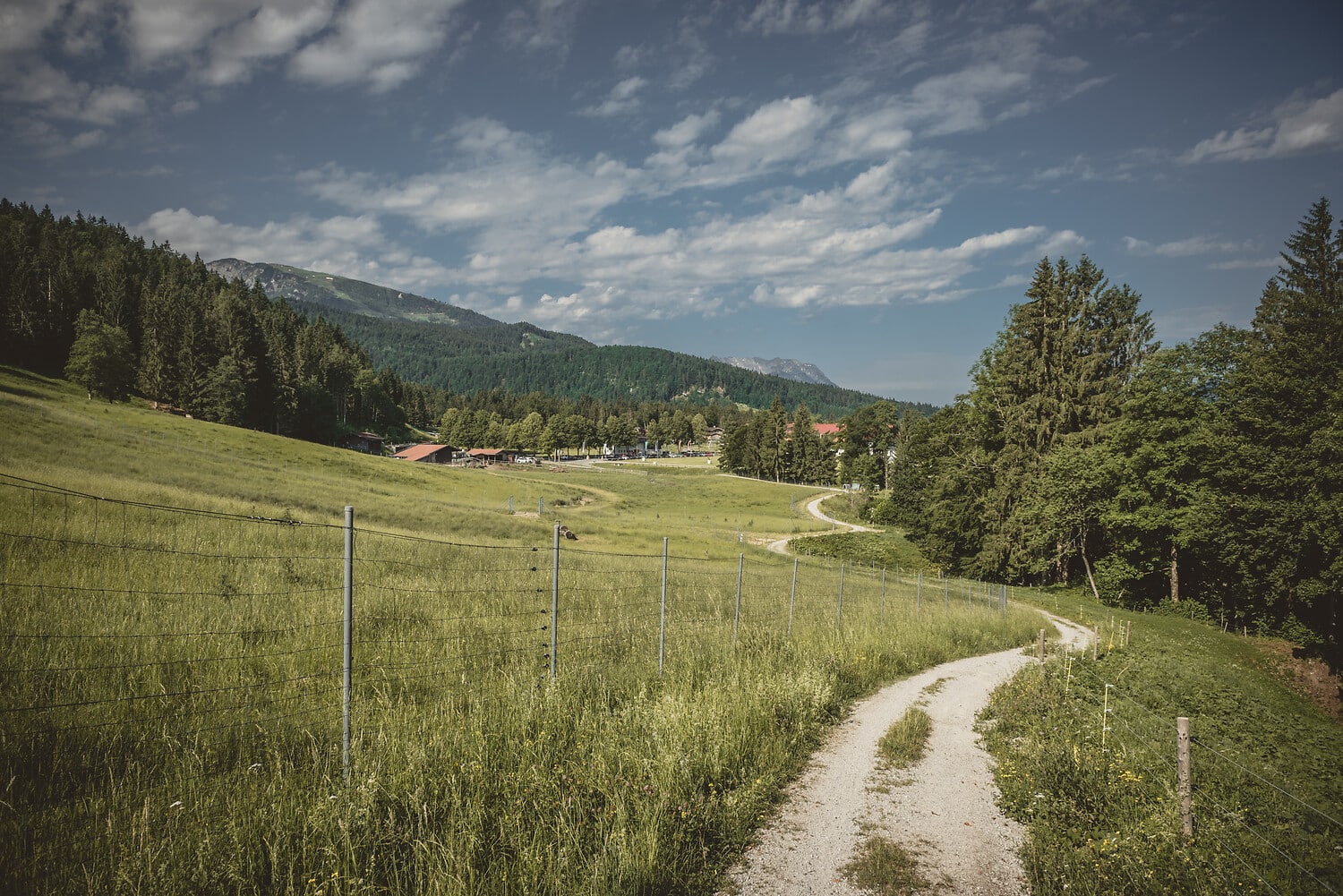
From the starting point, go via Dorfstraße to the church, then behind it via Hausbergstraße follow path no. 1 to the Eckkapelle and continue following the signs to Taubensee, paths no. 32, 3, 9.
Via the Stoibenmöseralm (path no. 9), continue to the Sauermöseralm (1,281 m) and to Taubensee. The return route leads via the Taubenseehütte, past the Hirzinghütte, then left to the Dichtleralm. Continue east across the alpine meadows to the Hutzenalm and back to the starting point via Birnbach.
Special features: “Tauernblick and Chiemseeblick” viewpoint near Stoibenmöseralm, romantic Lake Taubensee, path partly leads through Tyrolean territory, view of the Kaiser Mountains.
Refreshment stops: Stoibenmöseralm, Taubenseehütte, Hutzenalm, Gasthof Stoaner-Alm, Berghotel Birkenhof, farm café in the Oberbichl district.
Traunsteiner Hütte
See the directions for the Winklmoosalm. Now follow the Klammweg for 5 minutes heading northeast.
Good to know: Sturdy footwear is required! Outdoor clothing is recommended.
Length: approx. 10 km
Duration: 3 h
Elevation gain: 650 m
Reit im Winkl
Due to its beautiful natural surroundings and its moderately difficult route with a total elevation gain of 170 meters, this path is considered the pleasure via ferrata in Chiemgau. Enjoy the breathtaking view over Reit im Winkl during your summer holiday in Bavaria!
Distance: 2 km
Walking/Driving time: approx. 20 min on foot or 6 min by car
Nordic Walking in Reit im Winkl
Nordic Walking: Winklmoos Trail
The starting point is the beautiful Winklmoosalm. On the route, follow the circular hiking trail no. 7 “Winklmoos-Alm”.
You have the option of driving to the Seegatterl valley station. This is located approx. 5 km from our hiking hotel in Reit im Winkl if you follow the B305 towards Ruhpolding.
You now have several options:
Park your car free of charge at the Seegatterl valley station and either walk via the marked hiking trail 111/112 through the Dürrnbach gorge or via hiking trail 14 through the Schwarzlofergraben.
Park your car free of charge at the Seegatterl valley station and board bus line 9507, which will take you up to the hikers’ parking lot.
It is also possible to take this bus from the village.
For current timetables, please contact our reception staff.
Drive up the toll road in your car and park it at the Winklmoosalm hikers’ parking lot. Please note that you must have your guest card with you, otherwise the toll road costs €7.
If you wish to avoid any means of transport, please see the description “Hiking Trails (2) Winklmoosalm”.
Duration for the Winklmoos Trail: approx. 1 h 15 min
Route length: 5 km